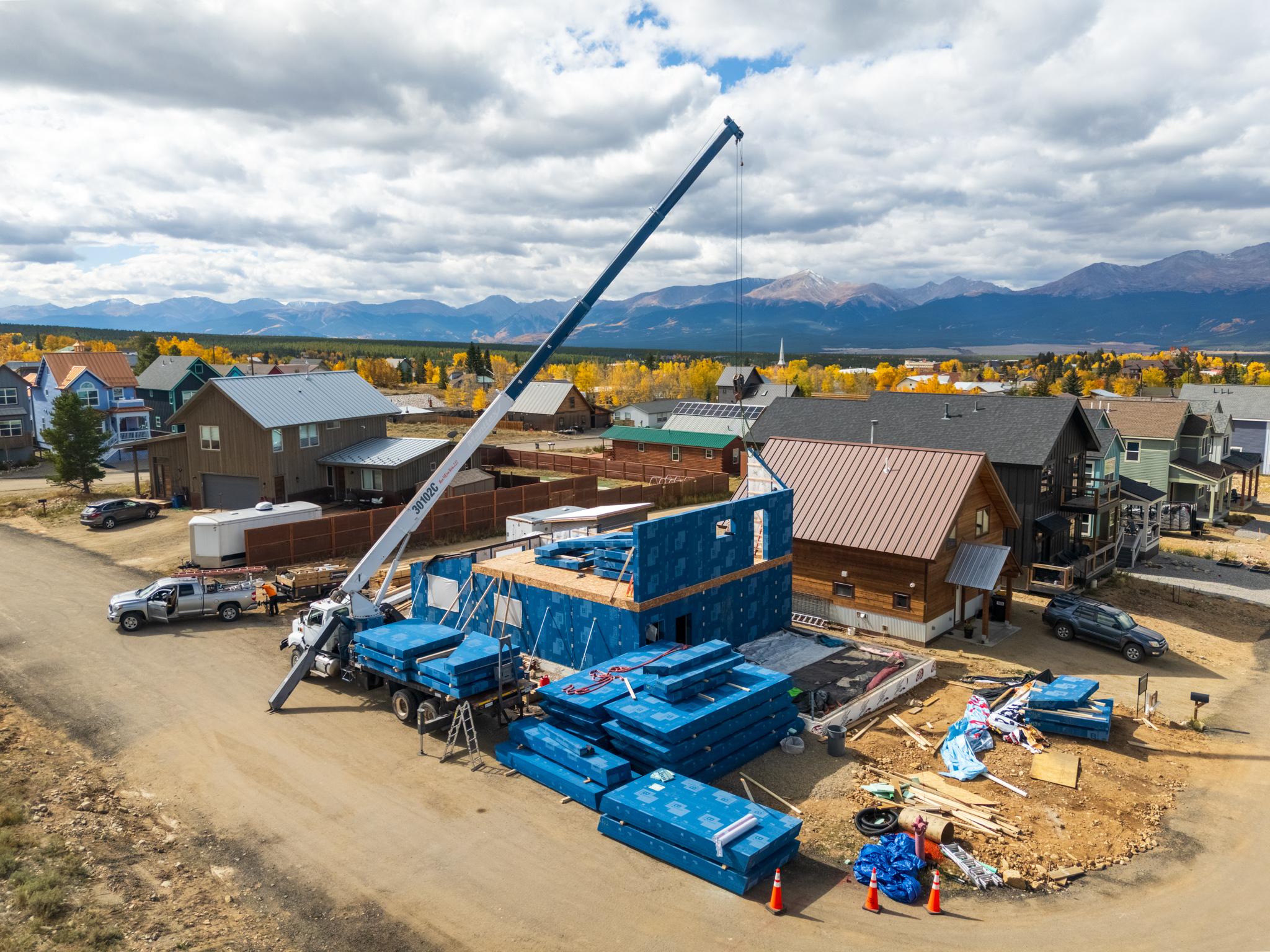
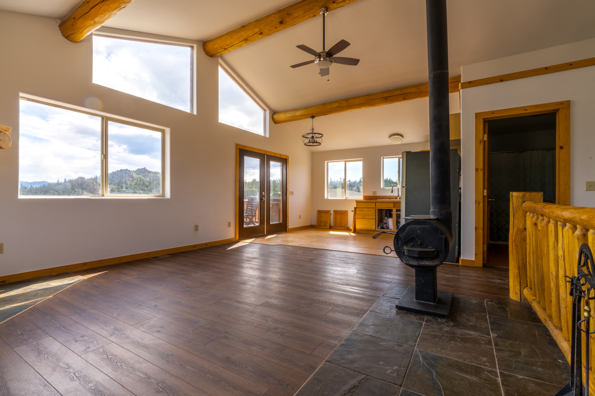
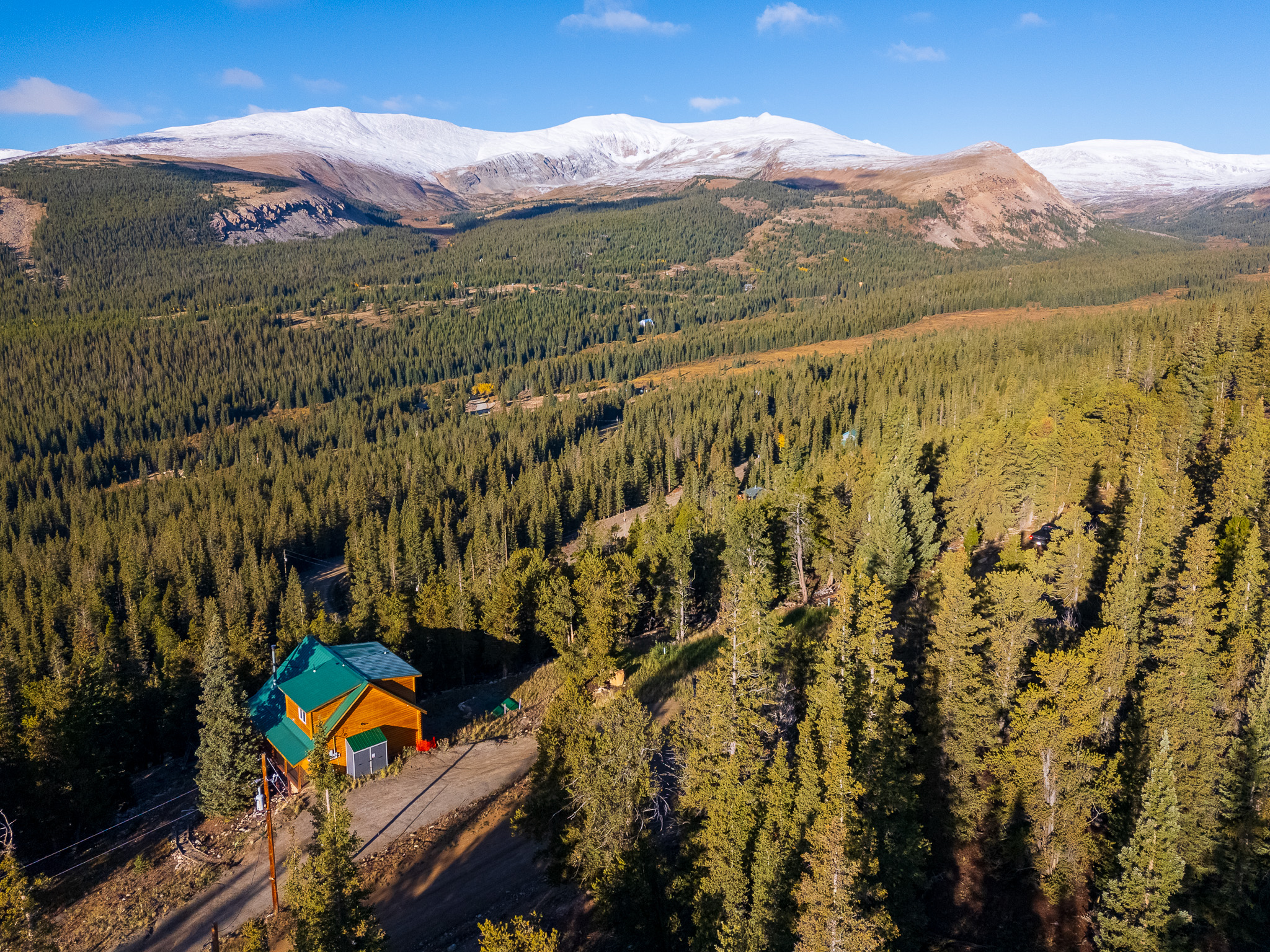
Capture Attention with Drone & Aerial Photography That Delivers
Fast, professional drone visuals that help your projects stand out — from construction to real estate.
Call/Text: (719) 839-1993
Email: hello@alanstenbackphotography.us
Or fill out the form below. We typically respond within a few hours – let’s get your project started.
Why Builders Choose Us
- Licensed, Insured & Compliant: FAA Part 107–certified and fully insured for commercial drone operations.
- Mountain-Tested Experience: Skilled in Colorado’s diverse conditions — from gusty alpine sites to remote backroads.
- Reliable Scheduling: Consistent availability and dependable service for ongoing projects.
- Fast Turnaround: Professionally edited imagery and video delivered quickly via secure digital download.
- Fine-Art Precision: Years of landscape and architectural photography inform our meticulous attention to detail.
Industries We Serve
- Construction & Development
- Roofing & Solar
- Real Estate & Property Management
- Utilities & Infrastructure
- Environmental & Land Survey
- Hospitality & Tourism
Our Process
- Consultation & Planning. We start with your project goals, scope, and site logistics to ensure every flight meets your needs.
- Flight Preparation & Safety Check. FAA compliance, weather, and airspace clearance are confirmed before takeoff for a safe, efficient operation.
- On-Site Capture. Our certified pilot captures precise imagery and data while maintaining safety and professionalism on every site.
- Editing & Delivery. Receive polished photos, maps, or 4K video via secure digital download — typically within 48 hours.
Services We Offer

Construction & Development Monitoring
- Track your project’s evolution from start to finish.
- Scheduled drone flights for consistent progress updates
- Aerial overviews for investor or stakeholder reports
- Orthomosaic and top-down mapping for large-scale sites
- Pre- and post-construction documentation for permits and compliance

Inspections & Technical Surveys
- Gain a safer, faster, and more cost-effective view of hard-to-reach areas.
- Roof and façade inspections
- Solar panel installations and maintenance checks
- Infrastructure and utility inspections
- Site condition documentation after storms or damage

Real Estate & Marketing Aerials
- Make listings and property showcases stand out from every angle.
- Dynamic aerial photos and video for MLS, Airbnb, and VRBO
- Neighborhood and community overviews
- Landscape and acreage documentation for ranches and estates

Professional Drone & Aerial Services
Serving Colorado’s Central Mountains & Beyond
Don’t let average visuals cost you clients, bookings, or project momentum.
Whether it’s construction progress tracking, roof and solar inspections, or high-impact aerial media for real estate and commercial projects — we deliver professional imagery that helps you stand out and move forward faster.
Our FAA-certified drone services provide detailed, high-resolution visuals to help you monitor builds, document milestones, and showcase your work with confidence — all without leaving the ground.
Aerial Imagery That Works as Hard as You Do
Why choose Alan Stenback Photography
• Get results that work: showcase projects, monitor builds, and elevate your marketing across websites, reports, and social media
• Fast turnaround: professionally edited photos and 4K video delivered within 24–48 hours (rush available)
• FAA Part 107 certified: fully licensed, insured, and compliant for commercial drone operations
From weekly site updates to structural inspections, we combine a fine-art eye with technical precision to create visuals that inform, impress, and perform.
About Us
Based in Fairplay, Colorado, we specialize in professional aerial, drone, and real estate photography that combines artistry with precision. From mountain properties to large-scale construction sites, our goal is to deliver visuals that inform, inspire, and perform — helping clients showcase, document, and market their projects with clarity and impact.
With a fine-art background and years of experience photographing Colorado’s rugged mountain terrain, Alan brings a creative yet detail-driven eye to every shoot. His approach blends composition, light, and perspective to tell the story behind every property, landscape, or project — whether it’s a mountain cabin, a development site, or a commercial build in progress.
We proudly serve Fairplay, Alma, Como, Jefferson, Hartsel, and all of Park County, as well as Breckenridge, Frisco, Dillon, Silverthorne, Summit County, and the greater Central Colorado Mountain region.
Our Mission
To provide real estate professionals, builders, and property owners with exceptional imagery and aerial data that highlight every project’s best features — helping listings sell faster, developments stay on schedule, and inspections get done safely and efficiently.
Our Vision
To elevate how Colorado’s properties and projects are seen — through creative imagery, advanced drone technology, and storytelling that captures both the beauty and the progress of mountain living, construction, and development.
Want to see our work in action?
Explore our Aerial & Drone Photography Portfolio showcasing construction, inspections, landscapes, and large-scale property coverage.
Trusted by Colorado Real Estate Professionals
Our clients include agents, builders, and property owners who rely on us for fast service, clear communication, and stunning results.
Frequently Asked Questions
What areas do you serve?
We serve Colorado’s Central Mountains with a primary focus on Park County and Summit County — including Fairplay, Alma, Como, Jefferson, Hartsel, Breckenridge, Frisco, Dillon, and Silverthorne. We also travel statewide for larger commercial or construction projects.
What types of aerial and drone services do you offer?
We provide professional drone and aerial photography for construction progress monitoring, roof and solar inspections, real estate marketing, mapping, and land documentation. Our FAA-certified operations ensure safe, compliant, and high-quality visuals for every project.
Are you FAA certified and insured?
Yes. Alan Stenback Photography operates under FAA Part 107 certification and carries full commercial drone insurance. Every flight is planned and executed with safety, compliance, and professionalism in mind.
Do you provide drone services for construction sites?
Absolutely. We specialize in aerial progress documentation for builders, developers, and contractors. Recurring site flights can be scheduled weekly or monthly to track progress, provide stakeholder updates, and capture project milestones from start to finish.
Do you offer roof, solar, or property inspections?
Yes. Our drone inspections provide a fast, safe, and cost-effective way to assess roofs, facades, solar panels, and other hard-to-reach structures — reducing the need for ladders or scaffolding while improving accuracy and efficiency.
Can you map or document large properties or land areas?
Yes. We offer aerial mapping, property documentation, and wide-area imagery ideal for large acreage, ranches, land developments, and environmental surveys. Orthographic overviews and top-down perspectives are available upon request.
How often can you capture progress on a job site?
We can schedule recurring drone flights weekly, bi-weekly, or monthly depending on project timelines. Consistent flight plans ensure accurate comparisons and professional documentation for reports and investor updates.
What kind of deliverables will I receive?
Typical deliverables include high-resolution photos (JPG or TIFF), 4K video footage (MP4), and optional orthomosaic or top-down site imagery. Files are delivered via secure download within 24–48 hours after the flight.
How do weather and mountain conditions affect scheduling?
Safety is always the top priority. High winds, rain, or snow may require rescheduling. We monitor forecasts closely and coordinate alternate windows to ensure safe flying and consistent quality.
What’s your turnaround time?
Standard turnaround for photos and videos is 24–48 hours after the flight. Rush delivery or same-day options may be available depending on project scope and weather conditions.
Do you travel outside of the Central Mountains?
Yes. We regularly travel throughout Colorado for construction, inspection, and commercial drone projects. A small travel fee may apply for remote or out-of-area locations.
How high can you fly?
All flights are conducted at or below 400 feet above ground level (AGL) in compliance with FAA Part 107 regulations. Altitude and approach are planned for each site to ensure safety, quality, and privacy.
What is the cost for aerial and drone services?
Pricing depends on project scope, flight location, and frequency. We offer one-time site visits, recurring flight packages, and bundled media options for construction or real estate clients. Contact us for a custom quote tailored to your project.
Can you provide both photo and video coverage?
Yes. Every flight can include both still photography and 4K video. You can request short clips for social media or longer edits for marketing, reporting, or presentations.
Can I see examples of your work?
Want to see our work in action?
Explore our latest collections:
Aerial & Drone Photography Portfolio showcasing construction, inspections, landscapes, and large-scale property coverage.
Real Estate Photography Portfolio featuring homes, cabins, and mountain properties across Park and Summit County.
How do I book a drone flight?
You can request a quote or schedule your flight directly through our website. Simply share your project location, type of coverage needed, and preferred dates. We’ll confirm airspace clearance and send you a proposal with pricing and options.
Are you available for ongoing partnerships?
Yes. We work with contractors, builders, property managers, and marketing teams who need recurring or long-term aerial coverage. Custom retainers and progress packages are available upon request.
Still have questions?
We’re happy to help. Reach out anytime to discuss your project, request a quote, or schedule your next flight — and let’s bring your vision to life from above.